Here’s the wrap-up of the week.
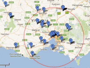
The map gives a general idea of where the food we ate came from. (I had trouble inserting it into the post so for now it’s a link to an external window). For some components I’ve had to choose to log them as either where the key ingredients were produced or where it was put together. For some it’s one and others, the other.
I did leave out the rather ludicrous extremely large distances, which would not only make the map big, but also make us look rather silly. (See the blog for details and excuses).
> Cheese from New Zealand – a mere 2,400kms.
> Mama’s homemade Ajvar, a mild salsa-like dip, journeying to us from Macedonia! – about 15,000kms. (bought from the Polish Deli in Albion).
> Sugar, used in cordial and custard day 1 and muffins Day 6. About 95% of Australia’s sugar is grown in Queensland.
> Soy milk – who knows where those beans are from …
Also worth noting that although we stayed in Buxton for the last 2 days (about 100kms from Footscray), I have kept the centre as Footscray for simplicity.
I encourage you to zoom out to see where the more distant things came from, and also to zoom in to locate the red markers (our place) and see the good things that were grown and produced on our own property.
If you want to further explore how you can ‘do it yourself’, check out the Local Harvest ‘Learn‘ resources.
> View Nick & Janet’s Challenge map > Download spreadsheet > Read blog posts


